
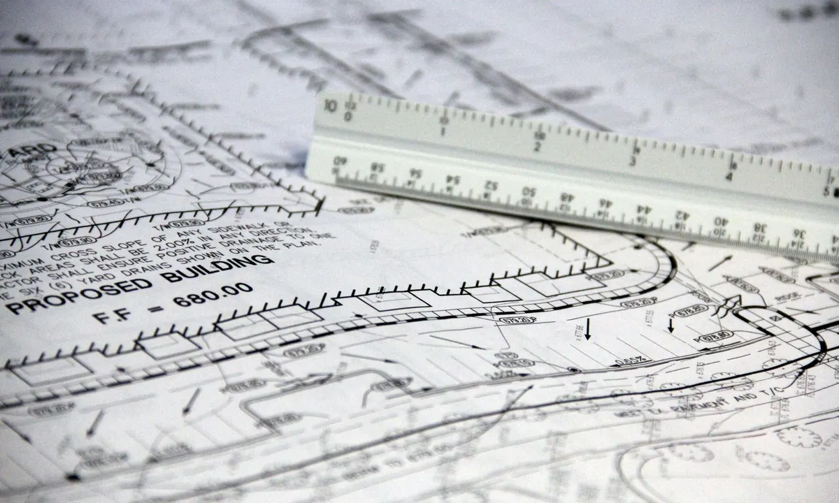
A plat map is the drawing that created your lot. When land is subdivided, a surveyor draws the whole subdivision: every lot and block, the streets, the easements, the building lines, and the measurements of each boundary. The local government approves it, and the plat is then recorded with the county recorder, register of deeds, or county clerk. From then on, a deed can describe your property simply as “Lot 14, Block 3” of that subdivision, with a reference to the book and page where the plat is filed.
To find your plat, start with the legal description on your deed or tax record. It gives you the subdivision name and usually the plat book and page (or cabinet and slide, volume and page, or instrument number). Look that reference up in the recording office’s map or plat index; many counties show the image online for free. This guide explains how a recorded plat differs from a tax map, a GIS parcel layer, and a survey, how to find yours, and how to read every part of it.
The short answer
- A recorded plat is a legal document. It is filed in the land records, and deeds that cite “Lot 14, Block 3” incorporate it. Tax maps and GIS layers are assessment tools, not legal boundary documents.
- Your deed points to your plat. Look for the subdivision name plus a recording reference such as “Plat Book 52, Page 18.” That reference is how the recording office indexes the map.
- The recording office holds the official copy. Depending on the state, that is the recorder, register of deeds, or county clerk. Some counties also post plats through the county surveyor or public works department.
- Read the whole sheet, not just your lot. Easements, building setback lines, curve tables, and plat notes often sit away from the lot itself, and a later replat can change what the original shows.
- A plat is not a survey of your house. It shows the lots as created. It does not show today’s fence, driveway, or addition. For a boundary question, hire a licensed land surveyor.
What a plat map is, and what it isn’t
In the strict sense, a subdivision plat (also called a recorded plat, final plat, or in California a tract map or parcel map) is the approved, signed map that divides a tract into lots, blocks, streets, and other areas and is filed in the public land records. Lots are then sold by reference to it.
A plat usually covers far more than one property. The Harris County Clerk in Texas puts it plainly on its real property records page (opens in a new tab): “A plat can be a section of a subdivision or an entire subdivision. Please note, these plats are not specific to one lot only.” Expect to find your lot as one of dozens or hundreds on the sheet.
The plat also has more authority than a picture of it. Florida requires every recorded plat to carry this notice, under section 177.091(27) of the Florida Statutes (opens in a new tab): “This plat, as recorded in its graphic form, is the official depiction of the subdivided lands described herein and will in no circumstances be supplanted in authority by any other graphic or digital form of the plat.” Other states don’t all require that wording, but the principle is common: the recorded document counts, not a redrawn copy on a website.
Not every property has a subdivision plat. Older rural tracts and land divided without a formal subdivision are often described by metes and bounds or, in most western and midwestern states, by the Public Land Survey System (section, township, and range). Our guide to the legal description of property explains those systems in depth. This guide focuses on lot-and-block property, where a recorded plat is the key document.
Plat maps vs. tax maps, GIS maps, and surveys
Five different documents get called a “plat map.” They come from different offices, for different purposes, and carry very different weight.
| Document | Who makes it | Legal weight | Where to get it | Good for |
|---|---|---|---|---|
| Recorded subdivision plat | Licensed surveyor for the developer; approved by the city or county | High. It is a recorded instrument, and lot-and-block deeds rely on it. | Recorder, register of deeds, or county clerk (map or plat records); sometimes the county surveyor | Lot dimensions, easements, building lines, dedications, plat restrictions |
| Assessor tax map (cadastral map) | Assessor or county mapping office | Low for boundaries. Made for assessment and drawn from recorded documents. | Assessor’s website or office | Finding parcel numbers, neighbors, map book and page |
| GIS parcel layer | County GIS or assessor, often digitized from tax maps and plats | None for boundaries. Approximate. | County GIS viewer | Orientation, aerial context, quick identification |
| Plat of survey, boundary survey, or ALTA/NSPS survey | Licensed land surveyor you or a buyer or lender hires | A professional opinion of where the boundary is on the ground, for one parcel | Your closing file, the surveyor who did it, or sometimes the recorder | Fences, encroachments, building near a line, closings |
| Plat book (landownership atlas) | Private map publishers, often sold through county extension or conservation offices | None. A reference snapshot. | County extension office, conservation district, or the publisher | Seeing who owns rural tracts, hunting and farm research |
Recorded subdivision plats
These are the documents this guide is mostly about. A developer’s surveyor prepares the plat, the planning authority reviews and approves it, owners and lienholders sign it, and the recording office files it with a permanent reference. Recording rules are set by state law and local ordinance. In California, the Subdivision Map Act generally requires a final map (called a tract map in many counties) for subdivisions of five or more parcels and a parcel map for four or fewer, with exceptions spelled out in Government Code section 66426 (opens in a new tab).
Assessor tax maps and cadastral maps
A tax map (the cadastral map an assessor keeps) shows every taxable parcel so the assessor can value it and the collector can bill it. It is built from deeds and recorded plats, not from new field surveys. New York’s general guide for tax mapping (opens in a new tab) describes the tax map as “a graphic display of each assessing unit’s land inventory” and “the major backup to the assessment roll,” and explains that mappers examine deeds and conveyances to plot each parcel.
Assessors are direct about the limits. The Los Angeles County Assessor’s mapping help page (opens in a new tab) says its maps “are prepared for assessment purposes only,” “show information AS RECORDED rather than as obtained … from an independent onsite survey,” and “are NOT surveys and as such should not be used in either defining property lines or in resolving disputes between neighbors.”
GIS parcel layers
The parcel lines on a county GIS viewer are usually a digital version of the tax map laid over aerial photos: useful for finding a property and its neighbors, but generalized and often shifted. We cover how far to trust them in Can You Trust Property Lines on a County GIS Map? The short version: use GIS to find the plat, then read the plat.
Plats of survey and ALTA/NSPS surveys
A plat of survey (or boundary survey) is a drawing a licensed surveyor makes after measuring one parcel on the ground. It shows the boundary as located, the corners found or set, and usually buildings, fences, driveways, and visible encroachments, which a subdivision plat drawn before your house existed cannot show.
Commercial deals typically use an ALTA/NSPS Land Title Survey, which follows national standards set by the American Land Title Association and the National Society of Professional Surveyors. ALTA’s land survey standards page (opens in a new tab) says the current 2026 standards took effect February 23, 2026, superseding the 2021 version.
Surveys are not always recorded. The Harris County Clerk notes that surveys “are only accepted for recording if they are attached as an exhibit to a document; they cannot be recorded as independent instruments.” Elsewhere they are recorded; Los Angeles County Public Works posts “Records of Survey” alongside tract and parcel maps. If you bought with a mortgage or title insurance, check your closing package first.
Plat books and landownership atlases
In rural areas, “plat book” often means a printed county atlas showing landowners’ names and tract boundaries by township and section. Private map publishers usually produce them, and county offices often sell them. Purdue Extension in Washington County, Indiana, for example, announced the 2026 Washington County Plat Book (opens in a new tab), with “landownership map pages showing townships and ranges … including property boundaries for all rural parcels.” They are handy for seeing who owns nearby land, but they are a snapshot, not a legal document.
Don’t confuse these with the recording office’s plat books or map books, the volumes where recorded plats are filed. A deed citing “Plat Book 52, Page 18” means that recording volume.
How to find the plat map for your property
- Get the legal description. It is on your deed, title policy, and mortgage, and a shortened version usually appears on the assessor’s record or your tax bill. If you don’t have a copy of the deed, our guide to searching deeds at the recorder of deeds walks through it.
- Pull out the subdivision name, lot, block, and recording reference. A hypothetical lot-and-block description reads: “Lot 14, Block 3, Cedar Ridge Section Two, according to the map or plat thereof recorded in Plat Book 52, Page 18, of the Public Records of Example County.” Write down the subdivision name exactly, including any section, phase, unit, or “addition” number.
- If the assessor’s description is abbreviated, use it as a lead. Assessor records often shorten the description (for example, “LT 14 BLK 3 CEDAR RIDGE SEC 2”) and may omit the plat reference. The Los Angeles County Assessor says its “Property Boundary Description” is “NOT a legal description, but rather an in-house write-up,” though it often includes the lot and tract number.
- Find the office that keeps recorded plats. This is usually the same office that records deeds: the county recorder, register of deeds, or county clerk. In some counties the county surveyor or public works department also posts plat images. Find your county’s offices through our state and county directory.
- Search the map or plat index. Look for a search labeled maps, plats, map records, or survey maps. Search by the recording reference if you have it; otherwise search by subdivision name. Try variations (“Cedar Ridge Sec 2,” “Cedar Ridge Section Two”) because indexing styles differ.
- Open every sheet. Large plats put the key map, notes, curve tables, and certificates on separate sheets. Download them all, and order a certified copy if a court, title company, or permit office asks for one.
- Check for later plats. Search the subdivision name again for replats, amending plats, or vacations recorded after the original. See replats, amending plats, and vacations below.
How plat recording references are written
Each office uses its own filing system, so the reference on your deed can look like any of these:
- Plat book and page, or map book and page: the classic bound-volume system, for example “Plat Book 52, Page 18” or “Map Book 1268, Pages 11–14.”
- Cabinet and slide (or sleeve): used where large plat sheets are stored flat in cabinets, for example “Cabinet B, Slide 245.”
- Volume and page of the map records: Harris County’s map index, for example, accepts volume and page.
- Film code or instrument number: a single document number assigned at recording, used by many offices after they moved to digital filing.
- Book of Maps with the year: Wake County, North Carolina, numbers its survey map books with “BM” and the recording year.
If the reference doesn’t fit the search form, call the recording office; staff can tell you how to enter it.
Three county examples
Harris County, Texas. The Harris County Clerk’s Maps and Condos search (opens in a new tab) covers recorded subdivision plats and condominium plats. You can search by file number, film code, volume and page, description (the subdivision name), or a date range. The page shows how current the index is. The clerk’s separate real property search (opens in a new tab) indexes deeds by subdivision, lot, and block, which helps you find the deed and then the plat. Directory page: Harris County, Texas.
Los Angeles County, California. The Registrar-Recorder does not provide online access (opens in a new tab) to real estate records or indexes, but recorded maps are another matter. Los Angeles County Public Works offers tract map downloads (opens in a new tab) by tract number or by map book and page; a file named “TR 1268-011,” the county explains, is Map Book 1268, Page 011. Its Land Records Viewer (opens in a new tab) lets you search tract maps, parcel maps, and records of survey by address or by the 10-digit AIN, so you can go straight from a tax bill to the plat. Directory page: Los Angeles County, California.
Wake County, North Carolina. The Wake County Register of Deeds says on its property map search page (opens in a new tab) that all survey and subdivision maps recorded since 1885 are available free online, and that map book numbers begin with “BM” followed by the recording year (for example, BM1999). Directory page: Wake County, North Carolina.
How to read a plat map
Plats look dense but follow a predictable layout. Florida’s plat statute makes a useful checklist because it spells out what a recordable plat must show. Section 177.091 of the Florida Statutes (opens in a new tab) requires many of the elements below, including a legend of all symbols and abbreviations. Items such as building lines and flood zone notes usually come from local rules rather than that statute. Other states differ in detail, but most modern plats show these.
1. Title block and location
Start with the name of the plat, usually at the top or in a corner. It gives the subdivision name and any section, phase, or unit number, the city and county, and often a location line such as the section, township, and range or the survey or grant the land came from. Make sure the name matches your deed exactly. “Cedar Ridge Section Two” and “Cedar Ridge Section Three” are different plats with different lots.
Look also for a vicinity map (a small inset locating the subdivision) and a key map or sheet index on multi-sheet plats.
2. North arrow and basis of bearings
The north arrow orients the drawing; plats are not always drawn with north at the top. Near it, or in the notes, you’ll usually find the basis of bearings: the line or coordinate system all directions on the plat are measured from. Florida requires bearings to be “referenced to some well established and monumented line.” Two plats with different bases can give the same line slightly different bearings, one reason to leave reconciling them to a surveyor.
3. Scale
The scale appears as a ratio such as 1" = 100' and usually also as a bar. The written ratio is only true at the original sheet size; once a plat is scanned, reduced, or zoomed, only the bar scale still works, because it resizes with the image. Better still, read the written dimensions instead of measuring.
4. Lot and block numbers
Lots are numbered in sequence, and in many subdivisions they are grouped into blocks, each with its own number or letter. Lot 14 in Block 3 and Lot 14 in Block 4 are different properties, so confirm both. Areas that aren’t building lots, such as open space, drainage areas, or amenity sites, are often labeled as tracts, reserves, or parcels with a letter (“Tract A,” “Reserve B”).
Some plats also mark an interior area “Not a part of this plat,” meaning it was excluded from the subdivision.
5. Bearings and distances
Each straight lot line is labeled with a bearing and a distance. A bearing such as N 89°52'14" E means: start facing north, then turn 89 degrees, 52 minutes, 14 seconds toward the east. Bearings written this way always start from north or south and turn east or west, so they never exceed 90 degrees. Some plats use azimuths instead, measured clockwise from north from 0 to 360 degrees; the notes or legend will say which. The distance is in feet, usually to hundredths (124.37'), and is a horizontal measurement.
Where lots share a line, the plat may show one overall bearing with individual lot distances, or put short lines in a line table (L1, L2, L3).
6. Curves and curve tables
Curved lot lines along cul-de-sacs and winding streets are described with curve data, either written along the curve or listed in a curve table keyed by labels such as C1, C2, C3. Florida, for example, requires curved lines to show radii, arc distances, and central angles, and street centerline curves to also show chord and chord bearing. Here is what the columns mean, with hypothetical values:
| Curve | Radius (R) | Delta (Δ) | Arc length (L) | Tangent (T) | Chord | Chord bearing |
|---|---|---|---|---|---|---|
| C1 (hypothetical) | 50.00' | 90°00'00" | 78.54' | 50.00' | 70.71' | N 45°00'00" E |
| C2 (hypothetical) | 275.00' | 12°30'00" | 60.00' | 30.12' | 59.88' | S 83°45'00" W |
- Radius: the distance from the curve to its center point. A small radius means a tight curve.
- Delta (central angle): how much of the circle the curve covers. A 90° delta is a quarter circle.
- Arc length: the distance along the curved line itself (radius times the delta in radians).
- Chord and chord bearing: the straight-line distance and direction between the curve’s two ends. The chord is always a little shorter than the arc.
- Tangent: the distance from each end of the curve to the point where the two straight lines leading into it would meet.
For frontage on a curve, use the arc length, not the chord.
7. Easements
Easements are strips where someone else, usually a utility or the public, has a right to use part of the lot. On a plat they are drawn as dashed lines or shaded strips with a label and width, such as “10' U.E.” (utility easement), “D.E.” (drainage easement), “S.S.E.” (sanitary sewer easement), or “access easement.” Common places to look: along the rear lot line, along side lines, and parallel to the street.
Check the legend, since abbreviations vary, and the plat notes, which often say what may be built in an easement. Florida requires plats to show each easement’s location, width, and intended use. Easements created by separate recorded documents may not appear on the plat at all, which is why a title search matters when you buy.
8. Building setback lines
A building line or building setback line (often “B.L.” or “B.S.L.,” for example “25' B.L.”) marks how far back from a lot line buildings must stay. It is usually drawn parallel to the street. A platted building line is a separate rule from the zoning setback; the two can differ, and you need to satisfy both, plus any deed restrictions. Ask the local planning or permitting office which setbacks apply before you design an addition, pool, or garage.
9. Streets and right-of-way widths
Streets are shown with their name and right-of-way width, for example “Oak Hollow Drive (60' R.O.W.).” The right-of-way is the full strip owned or controlled by the public, which is usually wider than the pavement. The platted lot line is usually at the edge of the right-of-way, not the curb, so the grass strip and sidewalk in front of many houses lie within the right-of-way rather than the platted lot.
10. Monuments and pins
Monuments are the physical markers that tie the plat to the ground: iron rods, pipes, concrete monuments, or disks set at the subdivision boundary, lot corners, and street centerlines. The legend explains the symbols; common abbreviations include “IRS” (iron rod set), “IRF” (iron rod found), and in Florida “P.R.M.” (permanent reference monument) and “P.C.P.” (permanent control point). These are the points a surveyor searches for when retracing your lot, so don’t move or remove one you find.
11. Flood zone notes
Many plats carry a note giving the FEMA flood zone and the Flood Insurance Rate Map panel and date in effect when the plat was approved, and some show minimum finished floor elevations. Treat that note as history. Flood maps are revised, so check the current effective map on the FEMA Flood Map Service Center (opens in a new tab) and ask the local floodplain administrator about any local requirements.
12. Dedications, certificates, and signatures
In the dedication, the landowner dedicates the streets, easements, parks, or other areas shown to the public or to a body such as a homeowners association, which tells you who is responsible for land that isn’t a building lot. Florida requires the purpose of every dedicated area to be stated. The certificate blocks show who signed and approved the plat: owners and lienholders (often notarized), the surveyor’s seal, the planning commission or governing body, and the recording office’s stamp with date and recording reference. That stamp is what shows you have the recorded version, not a preliminary draft.
13. Plat notes and restrictions
The general notes are easy to skip and often the most important part. They can restrict driveway access to a major road, set minimum floor elevations, assign maintenance of drainage areas, limit further subdivision, or point to separately recorded covenants. Florida requires a statement that “there may be additional restrictions that are not recorded on this plat that may be found in the public records of this county,” and that is good advice everywhere: deed restrictions and HOA covenants are usually recorded as separate documents.
Replats, amending plats, and vacations
The plat you find first may not be the last word. Lots are combined, split, or corrected after recording, usually by recording a new plat. Texas law illustrates the options. Under Texas Local Government Code chapter 212 (opens in a new tab):
- A vacating plat (section 212.013) cancels all or part of a recorded plat. Before any lot is sold, the owners can vacate it with approval; after lots are sold, all lot owners in the plat must apply.
- A replat (section 212.014) can be recorded and control over the earlier plat without vacating it, if it is signed by the owners of the property being replatted, approved by the city, and doesn’t try to amend or remove covenants or restrictions.
- An amending plat (section 212.016) fixes specific problems, such as an error in a course or distance, a monument shown incorrectly, or a clerical error in lot numbers, acreage, or street names. It also controls over the earlier plat.
Other states use similar tools under other names, such as lot line adjustments or resubdivisions. Florida requires a replat to say so in a subtitle naming the subdivision replatted and its recording reference. To find later changes, search the map index for your subdivision name and look for “replat,” “amending,” “resubdivision,” or “vacation.” If your parcel number changed, or the assessor’s legal description names a different plat than your deed, a replat is a likely reason.
Tax map numbers and parcel numbers
In many places the parcel number is built from the tax map, so it tells you which map page to open. Our parcel number guide covers formats in large counties; two systems show the link to maps clearly.
- Los Angeles County AIN (map book, page, parcel). The county’s property tax portal (opens in a new tab) explains that the 10-digit AIN “is comprised of a mapbook number, followed by a page number, followed by a parcel number.” So AIN 1234-567-890 is parcel 890 on page 567 of Assessor’s Map Book 1234. Don’t confuse it with the recorded tract map book: “Map Book 1268, Page 011” on a tract map refers to the recorded map volumes, a separate numbering system.
- New York section-block-lot. New York’s tax mapping guide (opens in a new tab) describes parcel numbers made of a section, block, and lot, written like 10.16-1-24. The section is the map sheet, the block a group of parcels on it bounded by streets or other features, and the lot a parcel within the block. New York City uses its own borough-block-lot (BBL) system; the city’s Digital Tax Map (opens in a new tab) warns that GIS information “should not be used as a substitute for engineer drawings or surveys.”
Tax map block and lot numbers are not the same as the block and lot on your subdivision plat. Your deed might say “Lot 14, Block 3” of a subdivision while the tax map lists the same land as block 1, lot 24. Use the plat’s lot and block for legal purposes, and the tax map number to search assessment and tax records.
When the plat and the GIS map disagree
This is common and usually not cause for alarm. GIS parcel lines are digitized from tax maps and recorded documents and laid over aerial photos, so a visible shift is common. Kitsap County, Washington, says in its cadastral mapping FAQ (opens in a new tab) that its parcel maps “are not surveys and should not be used as a definitive source of property ownership boundaries,” and that it does not adjust parcel lines to match what’s visible on aerial photos. Our GIS property lines guide explains why.
- Confirm you have the right plat. Match the subdivision name, section or phase, lot, and block to your deed, and check for a later replat.
- Compare dimensions and shape, not position. A GIS lot with the plat’s shape that sits a few feet off is usually an overlay issue. If the GIS shows the lot split, combined, or reshaped, ask the assessor’s mapping office which recorded document it used.
- Report mapping errors to the assessor. Send the plat reference and your parcel number. The assessor can correct its map; it cannot decide a boundary.
- Take boundary questions to a surveyor. If the question is where the line actually is on the ground, neither the plat image nor the GIS map answers it.
When to hire a land surveyor
The plat tells you what was created on paper; a licensed land surveyor tells you where it is on the ground today. Consider hiring one when:
- you plan a fence, wall, driveway, addition, pool, or outbuilding near a lot line or easement;
- a neighbor’s fence, shed, or driveway may be on your lot, or yours on theirs;
- corner markers are missing or don’t match the plat dimensions;
- you are buying land, especially vacant or rural land;
- a lender, title company, or permit office asks for a current survey; or
- the plat, deed, and assessor’s record give different dimensions or acreage.
Bring the surveyor your deed, the plat reference, any prior survey, and your title commitment. If a neighbor dispute is underway, talk to a real estate attorney too; for easement or access rights, a title company or attorney is the right contact, since those rights can rest on documents that aren’t on the plat.
Why a plat search comes up empty
The property isn’t in a platted subdivision
If the legal description is metes and bounds or section-township-range with no subdivision name, there may be no subdivision plat. Look instead for a recorded survey referenced in the deed, or ask the recording office whether surveys are indexed. Our legal description guide explains how to read those descriptions.
You are in the wrong index, or the name is indexed differently
Many offices keep plats in a separate map index (Harris County separates Maps and Condos from its real property search). Indexes may also abbreviate (“Sec,” “Ph,” “Addn”), drop “The,” or put the section number first. Search by a distinctive word in the name, or by the recording reference.
The image isn’t online, or it’s kept somewhere else
Some offices post only newer images; request older plats by recording reference. In some areas, such as Los Angeles County, the county surveyor or public works department posts the maps rather than the recorder. For a condominium, look for a condominium plat or declaration instead.
Frequently asked questions
How do I find the plat map for my property?
Get the legal description from your deed or tax record, note the subdivision name and plat book and page (or other recording reference), and search the map index at the county recorder, register of deeds, or county clerk. With only an address, start with the assessor’s record, which usually shows the subdivision, lot, and block.
Are plat maps free?
Often, for viewing. Wake County, North Carolina, for example, says its recorded maps are free to view online. Some offices charge for downloads or copies, and certified copies usually carry a fee.
What is the difference between a plat map and a tax map?
A recorded plat is the legal document that created the lots. A tax map is the assessor’s map of taxable parcels, drawn from deeds and plats for assessment. It helps you find parcel numbers but does not define boundaries.
What does lot and block mean?
It describes land by reference to a recorded subdivision plat, which divides the subdivision into blocks and numbers the lots in each, so “Lot 14, Block 3” plus the subdivision name and plat reference identifies one lot. See our legal description guide for how lot-and-block descriptions compare with metes and bounds.
Does a plat map show property lines? Is it the same as a survey?
A plat shows each lot’s lines as created, with bearings and distances, but not where they fall relative to today’s fences and buildings. A plat of survey by a licensed land surveyor covers one parcel and shows the boundary as located on the ground, usually with buildings and encroachments.
What is a plat book?
Either the recording office’s volumes of recorded plats (hence “Plat Book 52, Page 18”) or, in rural areas, a printed county atlas of landowners and tract boundaries, often sold through county extension offices.
Can I build in an easement shown on my plat?
Often not, or only with limits. It depends on the easement’s terms, the plat notes, and local rules, so ask the permitting office and the easement holder before you build. If the terms are unclear, a title company or real estate attorney can review them.
Find the recorder, assessor, and GIS map for any county in our state and county directory. To identify the property first, see our parcel number guide.